MOUNT LEROY
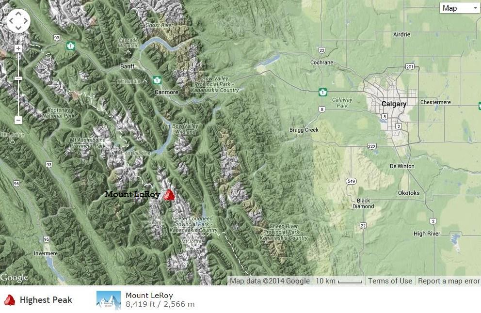
Mount LeRoy: 2970m (9745ft.)
Located between the Palliser River and LeRoy Creek.
Major headwater Kootenay River.
Latitude 50; 41; 55
Longitude 115; 20; 00
Topo map 82J/11
Named in 1919.
Leroy, Osmond Edgar
(A former head of the Geological Survey of Canada, Osmond Leroy was killed in action at Passchendale in WW I.)
Located between the Palliser River and LeRoy Creek.
Major headwater Kootenay River.
Latitude 50; 41; 55
Longitude 115; 20; 00
Topo map 82J/11
Named in 1919.
Leroy, Osmond Edgar
(A former head of the Geological Survey of Canada, Osmond Leroy was killed in action at Passchendale in WW I.)
Mount LeRoy
By: Mountain Nerd
Height: 2939m (9642 ft) Province: British Columbia
Latitude-Longitude: 50.69797,-115.33791
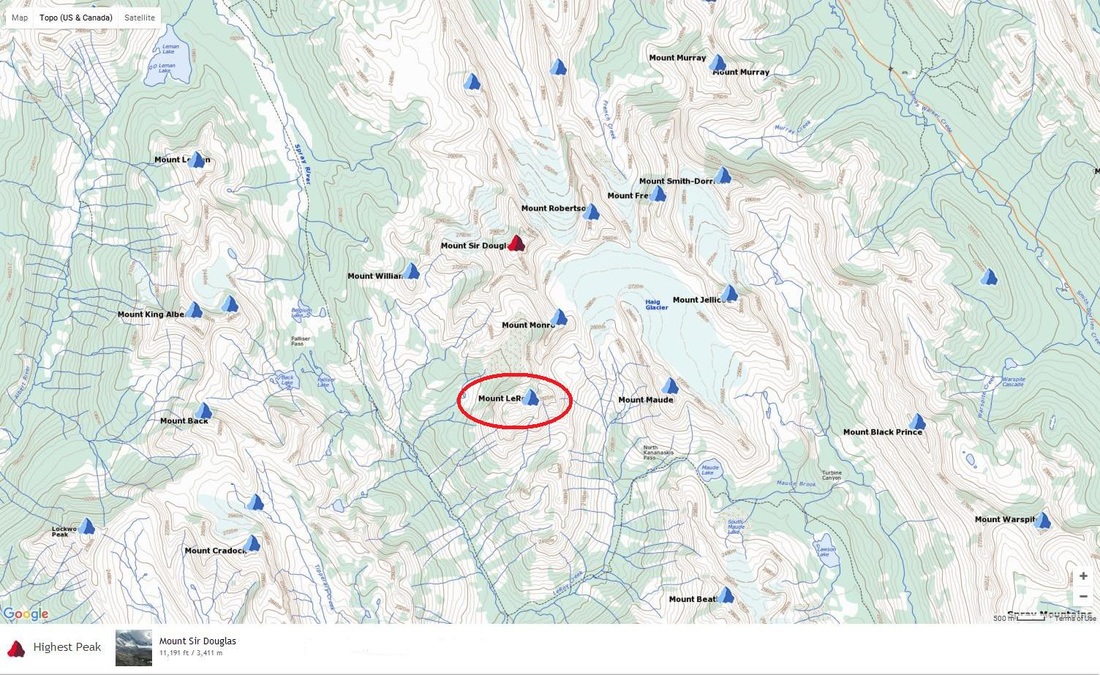
15th highest in the Spray Mountains.
24th highest in Height of the Rockies Provincial Park.
756th highest in the Canadian Rockies South.
763rd highest in the Canadian Rockies.
1815th highest in the Western Cordillera.
The closest higher mountain is Mount Monro, 1km away.
By: Mountain Nerd
Height: 2939m (9642 ft) Province: British Columbia
Latitude-Longitude: 50.69797,-115.33791
15th highest in the Spray Mountains.
24th highest in Height of the Rockies Provincial Park.
756th highest in the Canadian Rockies South.
763rd highest in the Canadian Rockies.
1815th highest in the Western Cordillera.
The closest higher mountain is Mount Monro, 1km away.
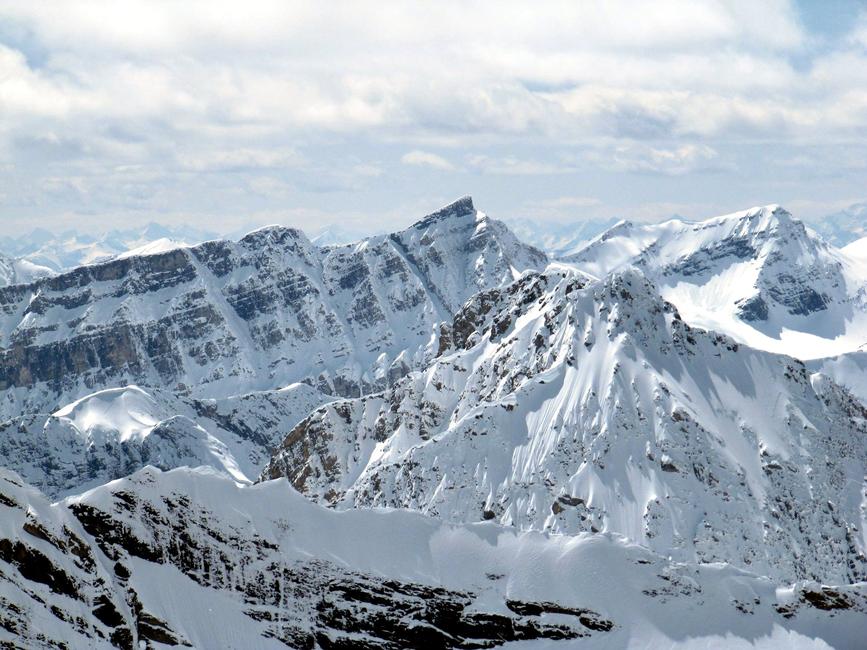
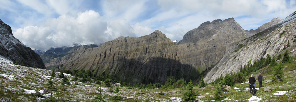
Looking North to Mount Sir Douglas on the left and Mount Richardson above the Haig Glacier.
In front of Sir Douglas is Mount Monro and Mount LeRoy(?)
It is hard to tell where both of those peaks are in this shot.
On the right is Mount Maude.
Out of sight below Mount Maude is North Kananaskis Pass.
Peakery
Farther to BC, Mount Leroy said who's peeing on our side, you stupid Albertan.
| north_kananaskis_pass_-_hiking_in_kananaskis_country__kananaskis_lakes_.pdf |
